Blog
Climate change exercise - Part I
"The coldest summer of the rest of our lives."
The summer season in the northern hemisphere has ended, leaving record temperatures in Europe and unprecedented drought.
The fact that it has been hotter than ever is not mere perception. Data from the Copernicus satellite system detected that the global average temperature for August 2022 was 0.3ºC higher than the average for 1991-2020, making it the third warmest August.
But 0.3 degrees doesn't seem like a big deal. Let's see what happened in Europe:
Climate change and data journalism
It is not easy to cover climate change issues. There is a lot of skepticism and denial about the fact that global temperatures have been increasing progressively since the industrial revolution.
However, resources abound: historical temperatures, average temperatures, minimum and maximum temperatures, and temperature anomalies are available to all those who want to explore climate change issues with a more data journalism or fact-checking vision.
There is a lot of interest in the media to cover climate change issues in the most accurate way possible. Media like NYTimes are hiring even more and more specialists, like graphic reporters, cartographers, developers, and data journalists
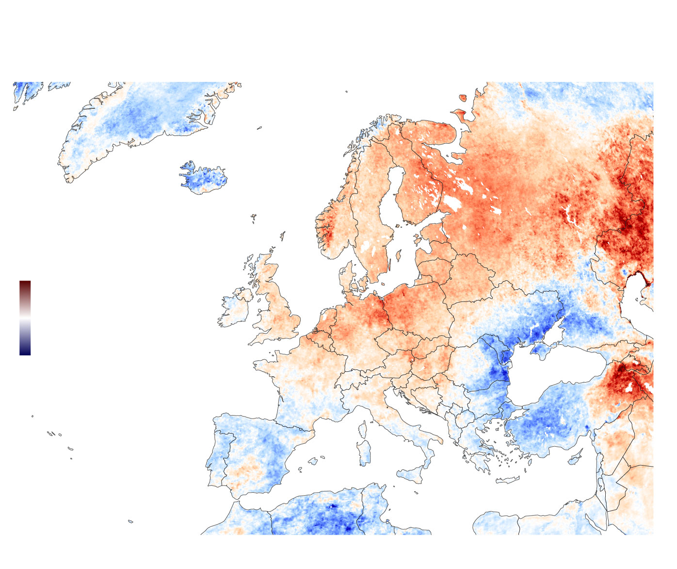
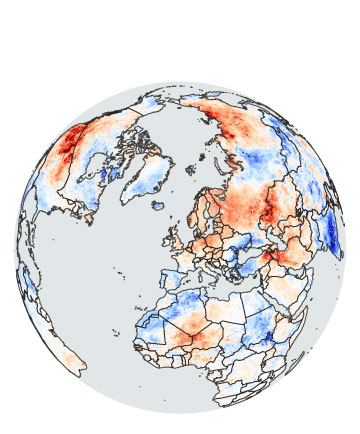
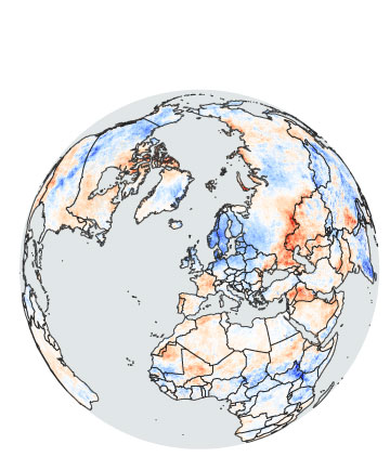
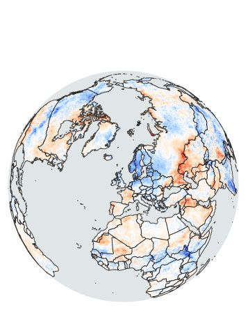
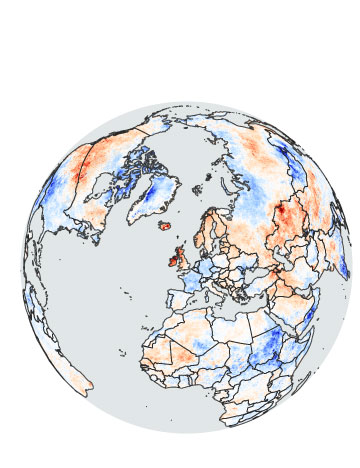
One of the things I like most about covering climate change and data visualization is that you can easily compare the changing temperatures year to year, like these maps of the difference in anomalies between August 2021 and August 2022 in Europe with data extracted from NASA.
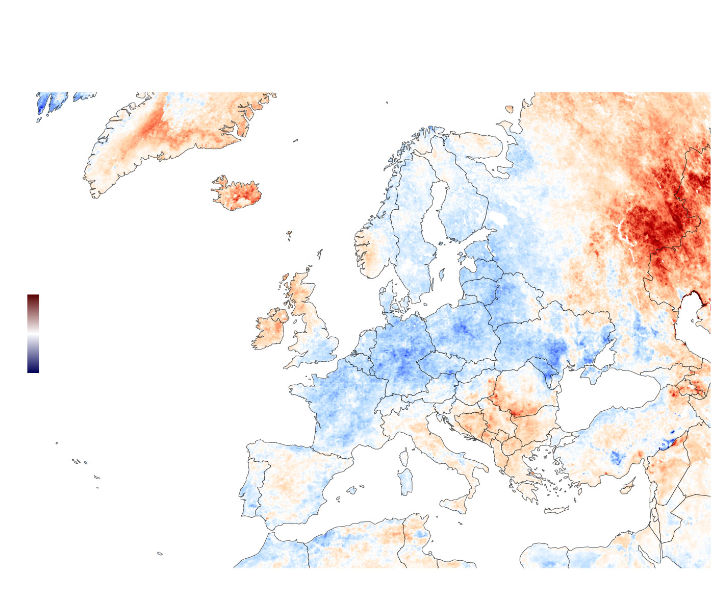
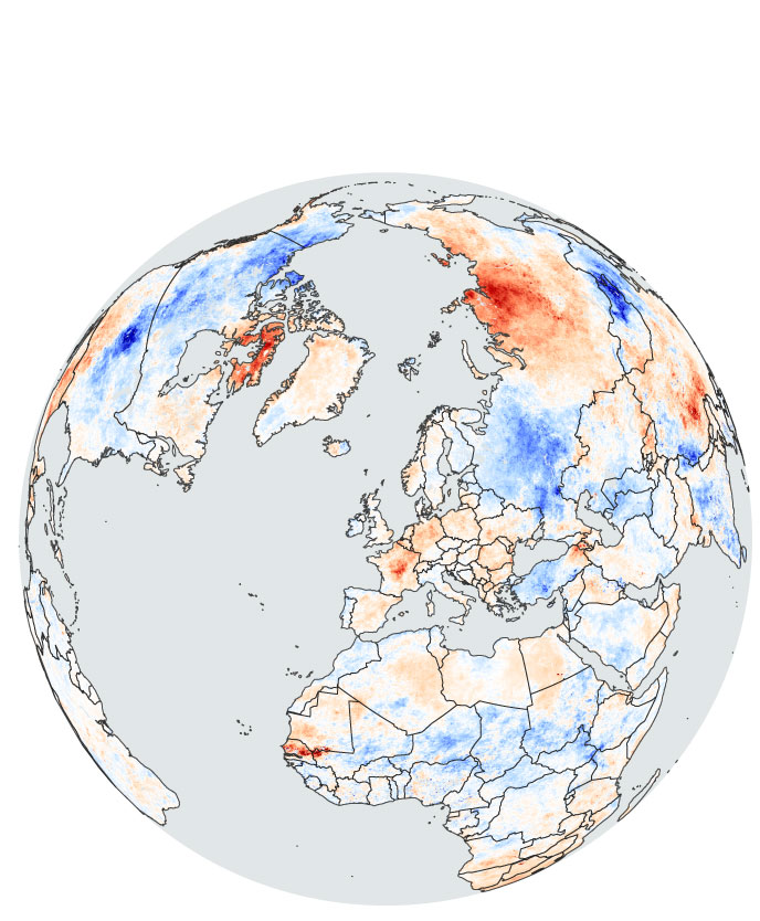
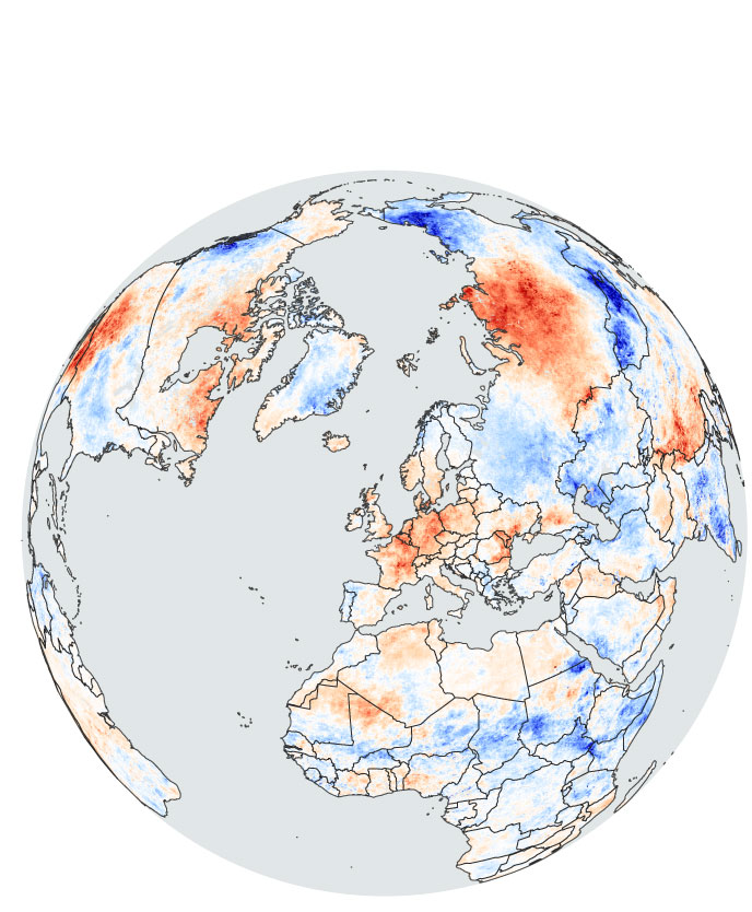
August 2021
Iceland
Norway
Finland
Russia
Sweden
12 ºC
Belarus
UK
Poland
Ukraine
Ireland
Germany
-12 ºC
Romania
France
Turkey
Italy
Portugal
Spain
Greece
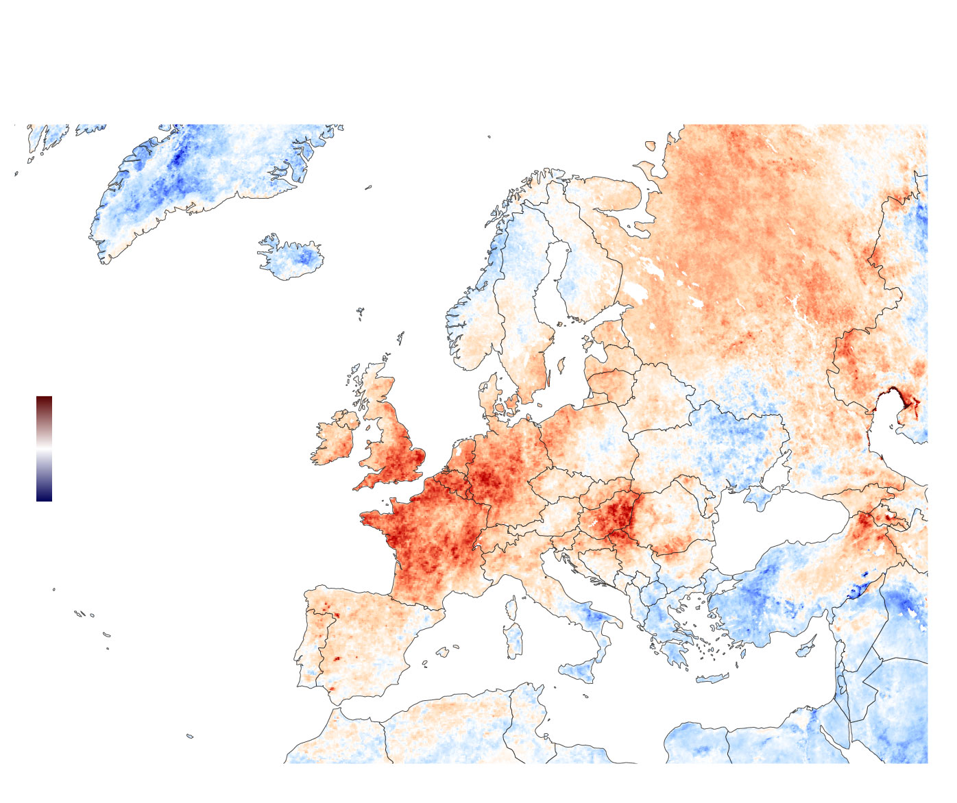
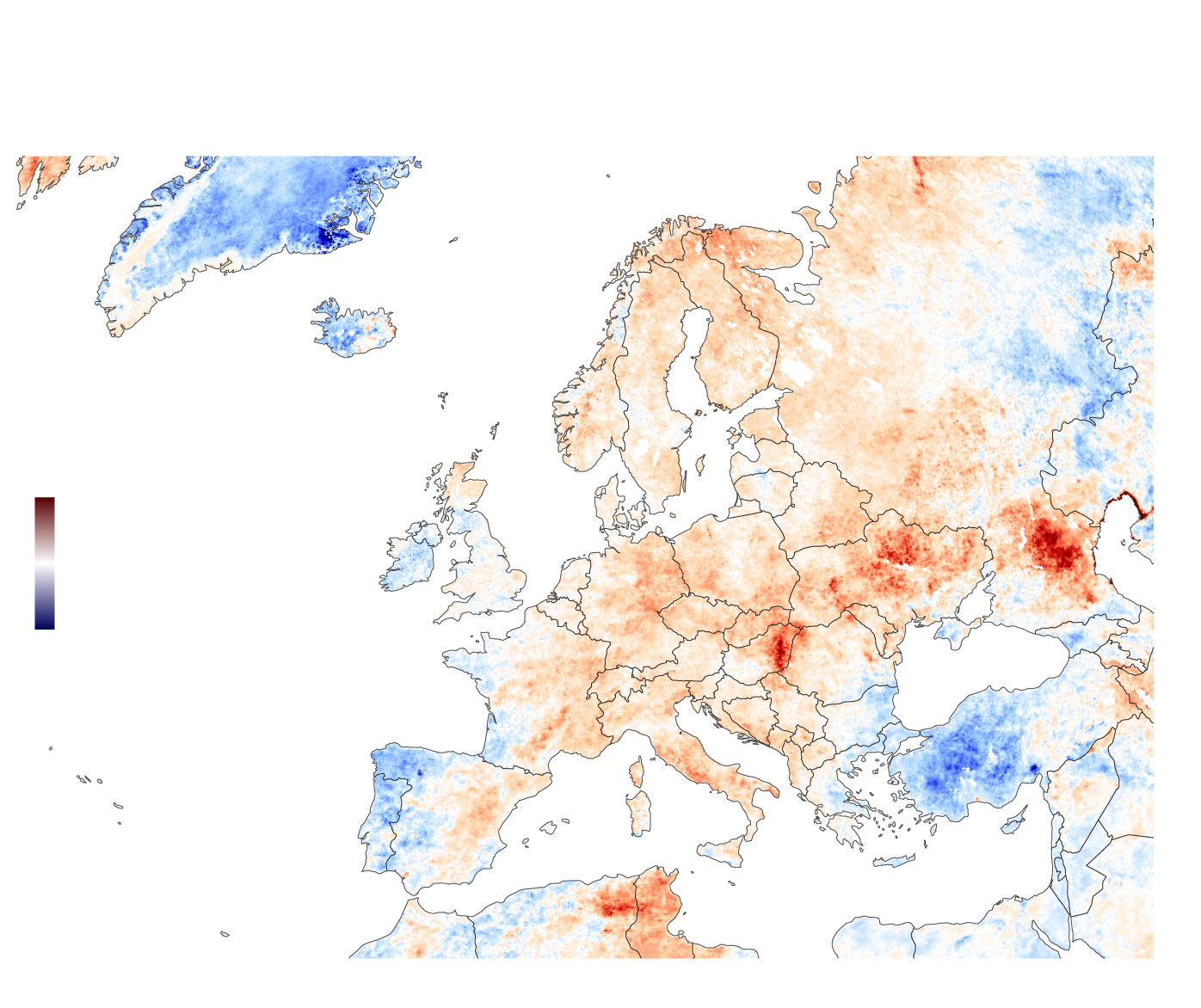
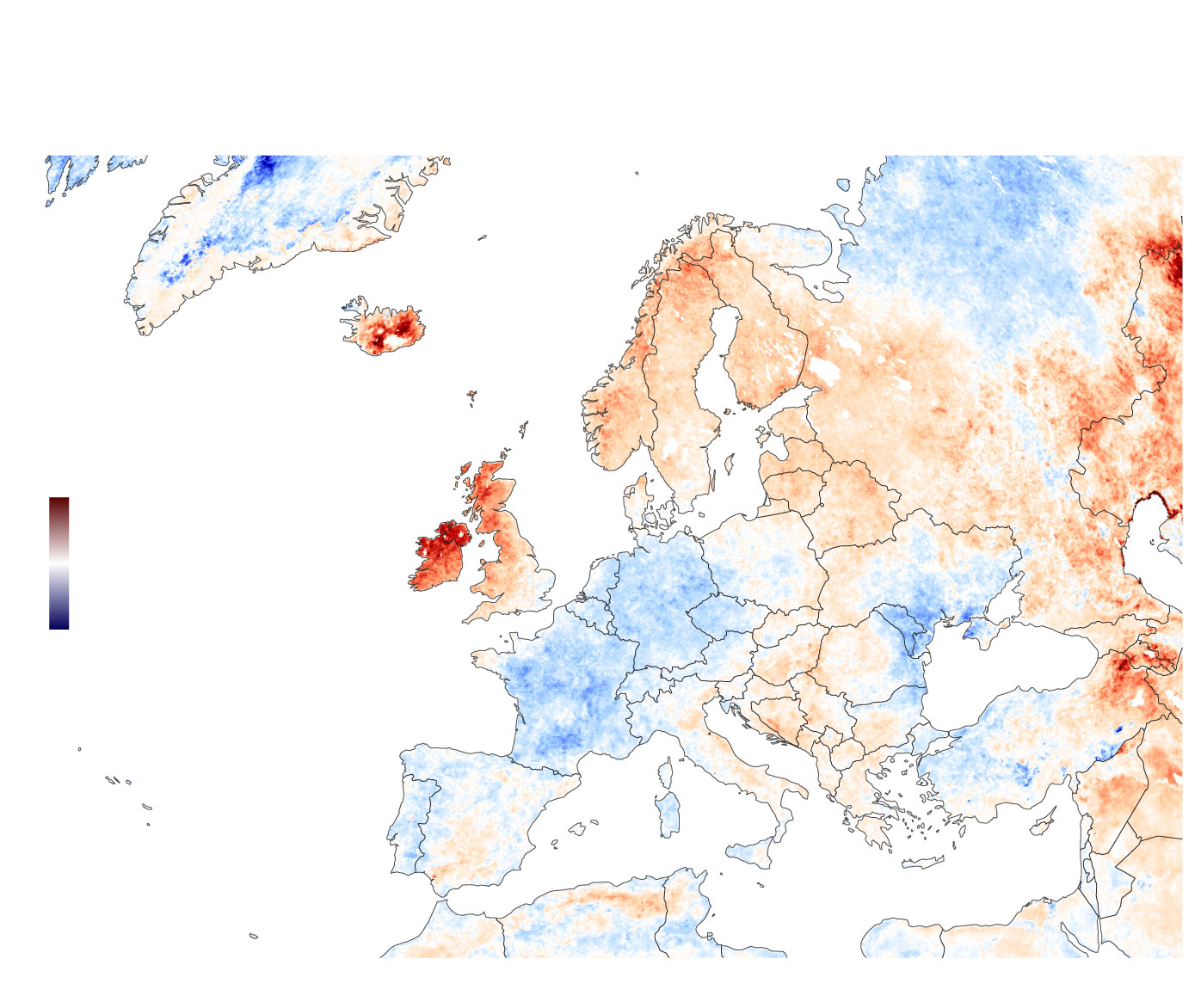
August 2022
Iceland
Norway
Finland
Russia
Sweden
12 ºC
Belarus
UK
Poland
Ukraine
Ireland
Germany
-12 ºC
Romania
France
Turkey
Italy
Portugal
Spain
Greece
You can see the temperature anomalies in August 2022 were much higher in comparison with 2021.
This doesn´t say much. 2022 could be only a hotter year than 2021. Or vice versa. The real job is to show the trend in rising temperatures over time. We will need more data to make that.
However, it is not my mission today to show the temperature trend since the industrial revolution. Let's do something simple.
Hands on deck!
Creating comparative maps is jobless if you know where to pull your data from and have the right tools.
For these types of maps, I like to use my favorite mapping tool: QGIS. It is a powerful open-source Geographic Information System (GIS) that allows you to import and export different formats, from shapefiles to JSON.
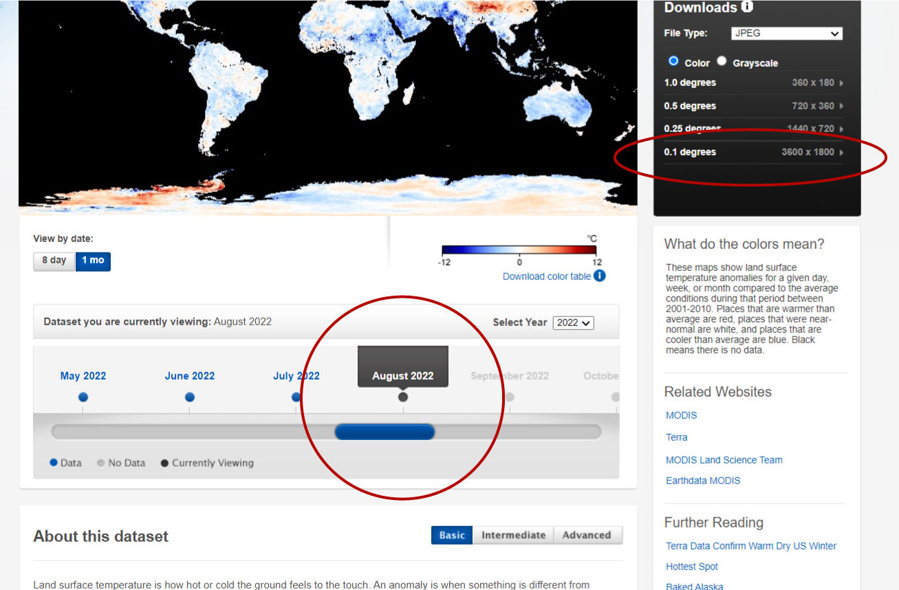
Let´s go to the Nasa Earth Observation website, from where I extrated the data. We are gonna use the data for anomalies.
In climate change studies, temperature anomalies are more important than absolute temperature. A temperature anomaly is the difference from an average, or baseline, temperature. The baseline temperature is typically computed by averaging 30 or more years of temperature data.
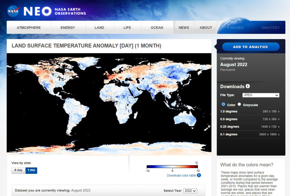
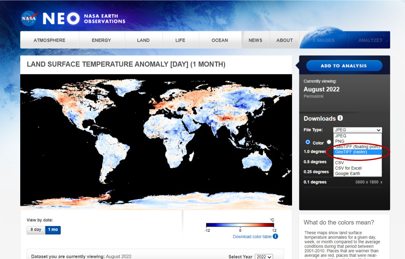
We are gonna download the raster file (GeoTIFF). You could download the JPG or PNG files, but those are only image files, and we want something we can change.
Also, make sure you´re downloading the right date. In my case, I want to start in August 2022.
We download our file by clicking on the resolution we want.
QGIS time!
I´m not going to explain everything about QGIS. That might be a different post for the future.
We are going to click on Layer >> Add Layer >> Add raster Layer...
When the new window pops up, select the TIFF file in the section of Source and then Add.
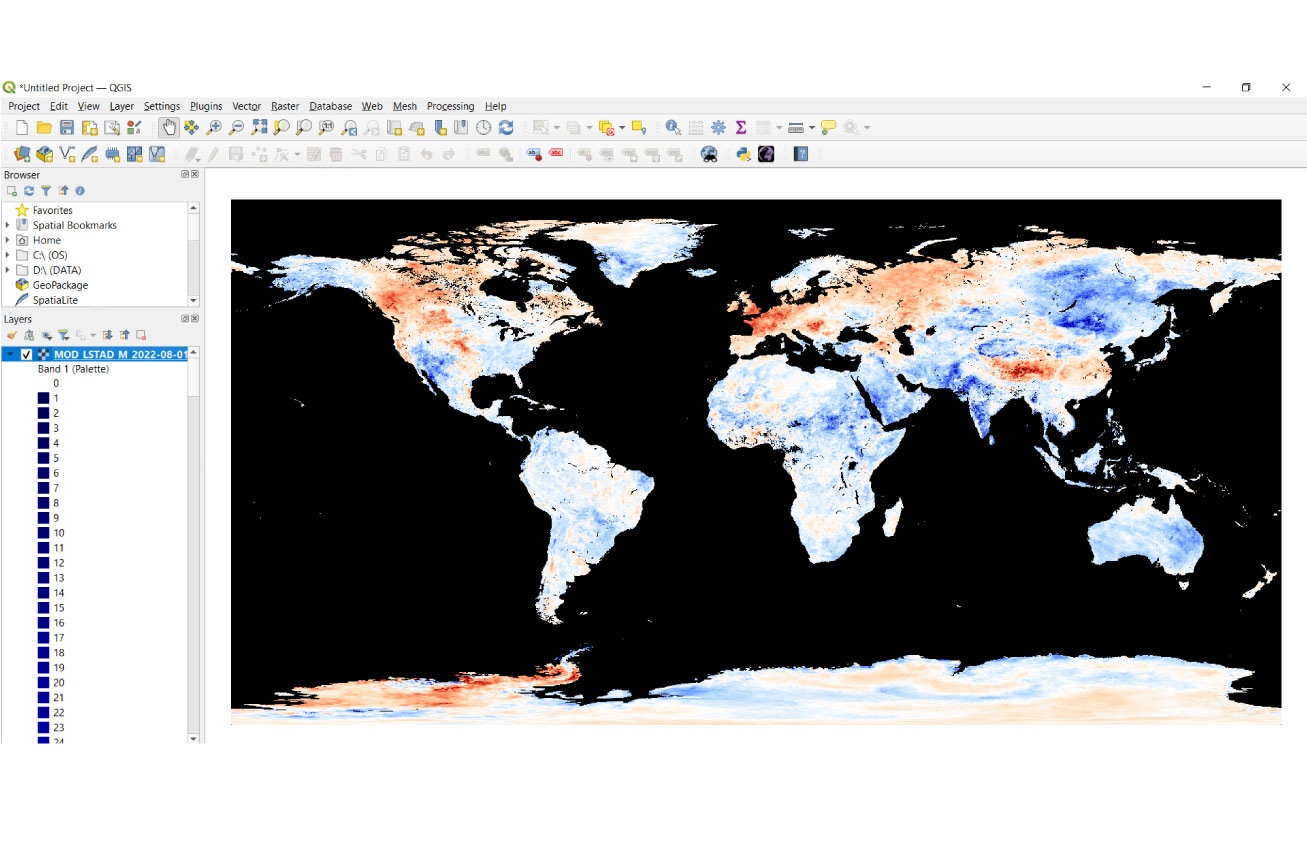
We have our first map, but I don´t like the colors. I prefer something different for the background.
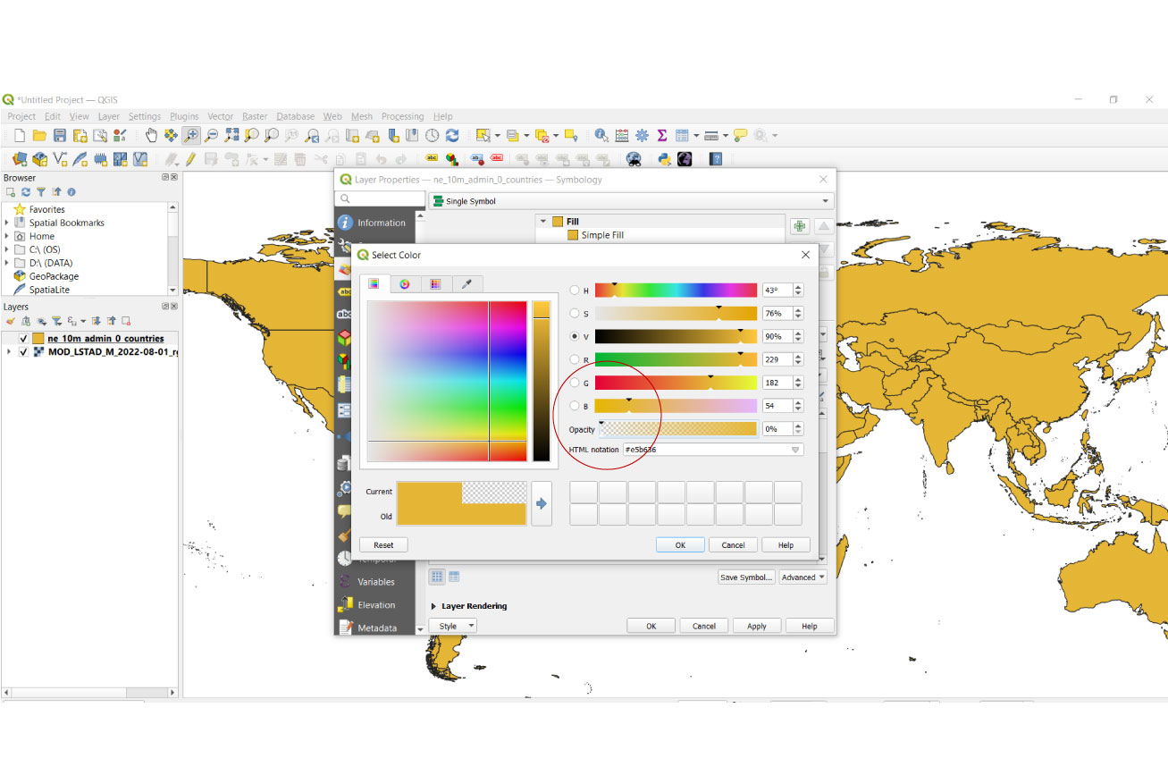
We have our first map, but I don´t like the colors. I prefer something different for the background. Let´s double click on our map layer and select Symbology.
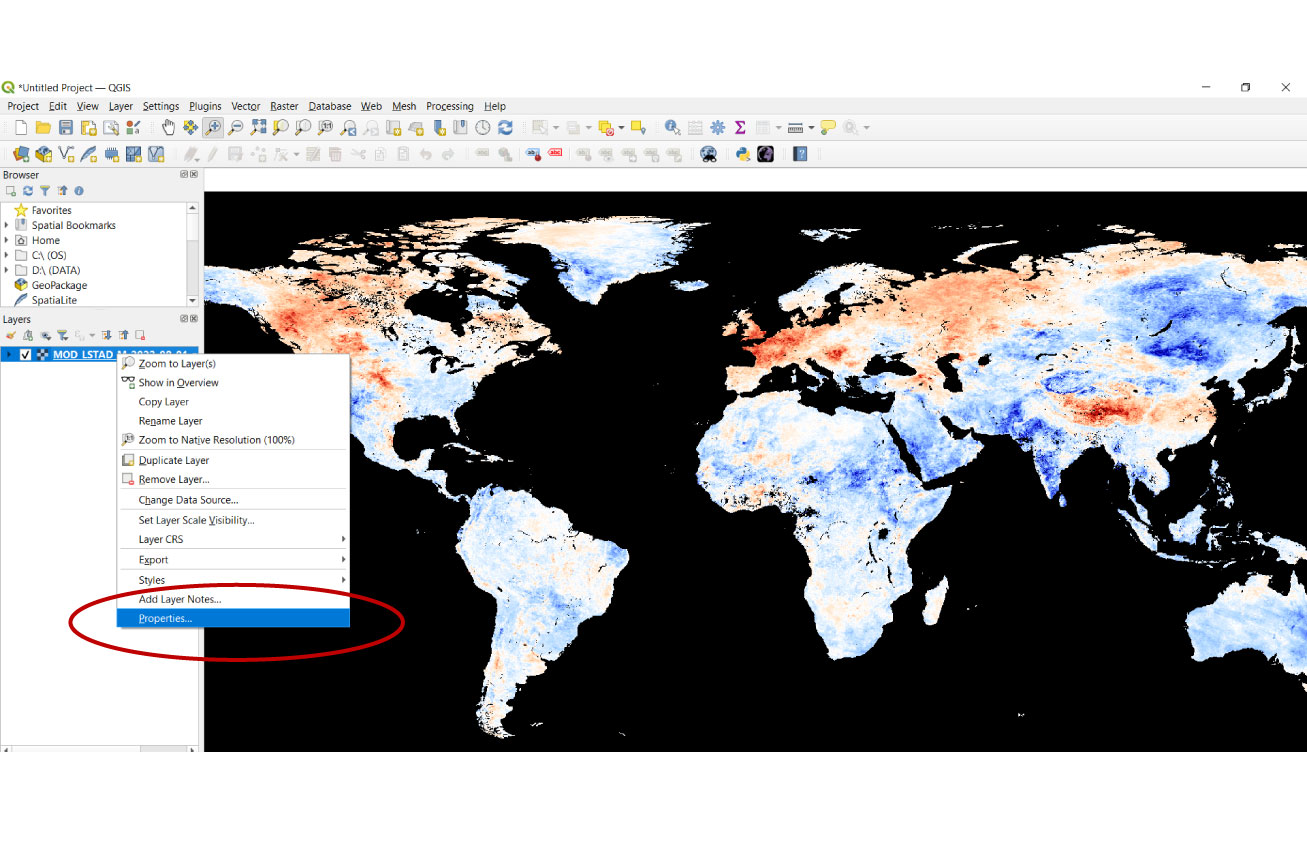
We have now our color palette. Technically, we can change the colors as we want. But I like the combination of blue and red. I only want to change the background to make it look nicer.
We scroll down until the last color, which is black. Double-click on it and change it to white.
We say Ok and Ok again. We have out white background now.
Countries
Our map is not complete. We are missing the country's borders.
For that, we will need a shapefile. There are many resources on the Internet, but I like using Natural Earth.
In Downloads, we select Large scale data, 1:10m >> click on Cultural. Then, we download Admin 0 – Countries.
We are doing the same we did with the TIFF file. After unzipping the Natural Earth Data files we just downloaded, we will import it in QGIS by clicking on Layer >> Add Layer, but this time, we select Add Vector Layer...
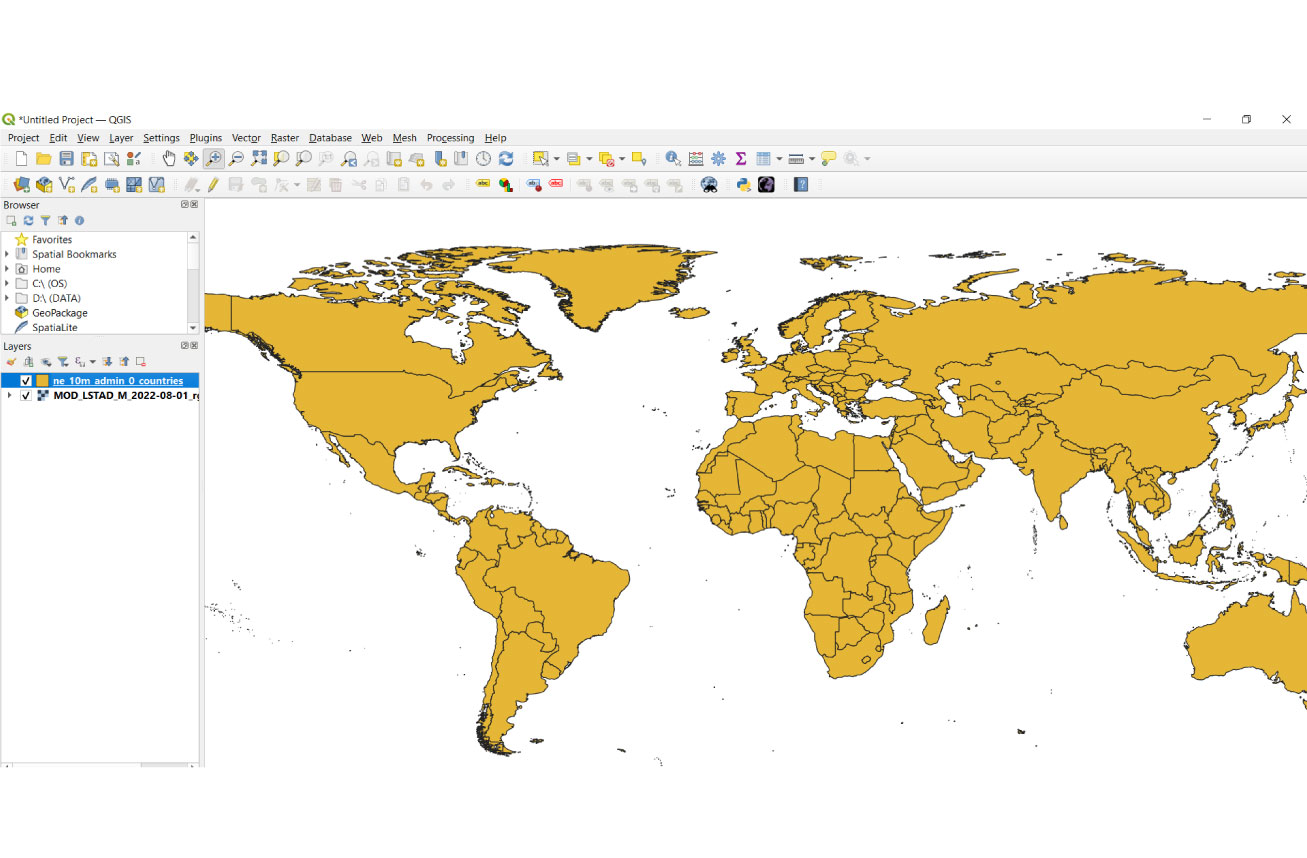
Great job. But I wanted only the lines and the country layers hiding my map with the temperature anomalies. We double-click on the countries layer as we did previously, and change the opacity of the color to 0.
We have our map now.
Exporting
We only have now to export our map. Let´s do it using the New Print Layout.
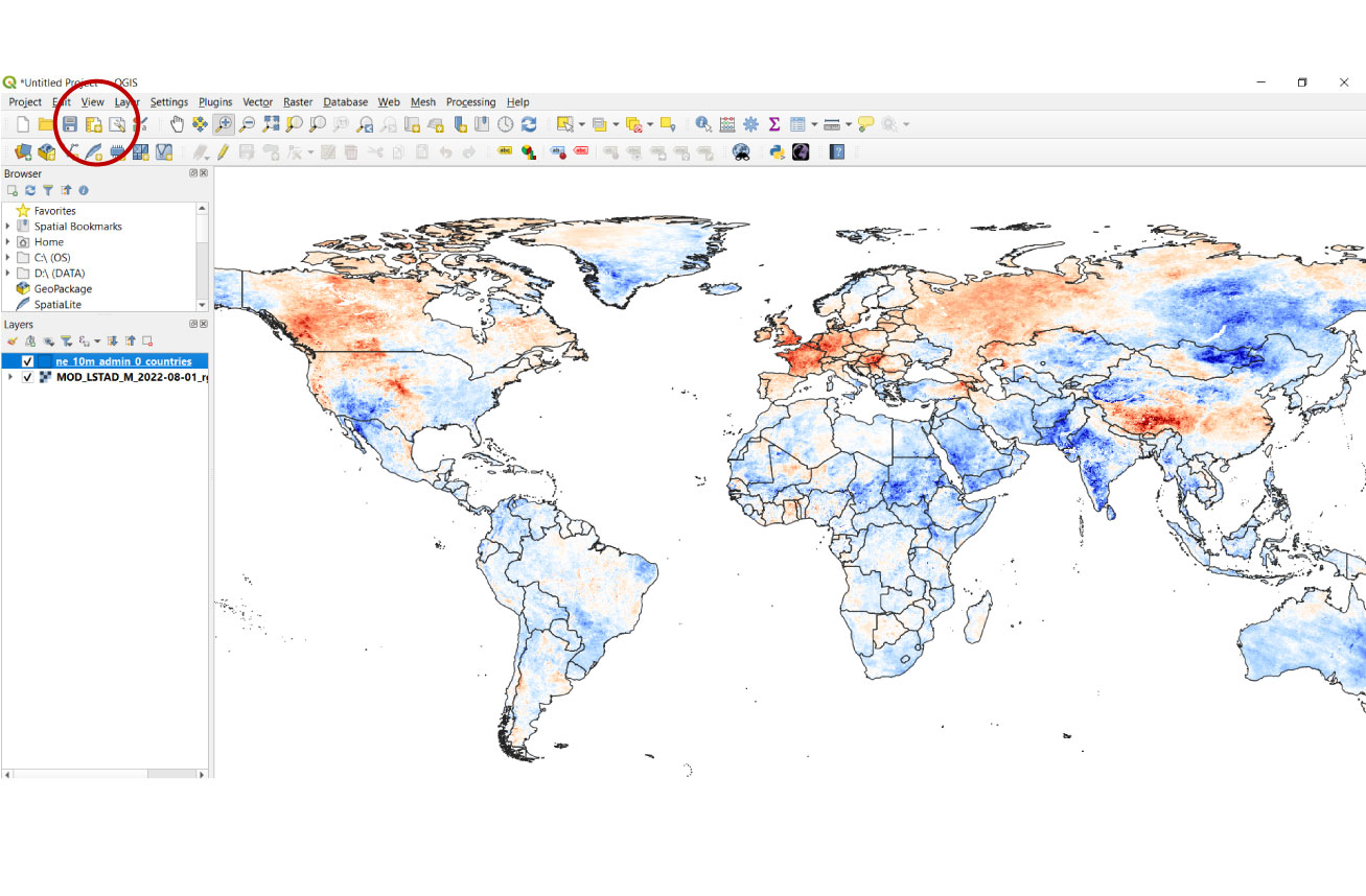
QGIS allows you to export your map in different files, such as SVG, JPG, or PDF. I like SVG to change my map with Illustrator for the last details, like the name of the countries or titles.
This is the easiest way to use QGIS. The possibilities with QGIS are endless, but that comes after this post. You can make more maps by downloading more data from the NASA website, like the following maps.
June 2021
Iceland
Norway
Finland
Russia
Sweden
12 ºC
Belarus
UK
Poland
Ukraine
Ireland
Germany
-12 ºC
Romania
France
Turkey
Italy
Portugal
Spain
Greece
June 2022
Iceland
Norway
Finland
Russia
Sweden
12 ºC
Belarus
UK
Poland
Ukraine
Ireland
Germany
-12 ºC
Romania
France
Turkey
Italy
Portugal
Spain
Greece
July 2021
Iceland
Norway
Finland
Russia
Sweden
12 ºC
Belarus
UK
Poland
Ukraine
Ireland
Germany
-12 ºC
Romania
France
Turkey
Italy
Portugal
Spain
Greece

July 2022
Iceland
Finland
Russia
Norway
Sweden
12 ºC
Belarus
UK
Poland
Ukraine
Ireland
Germany
-12 ºC
Romania
France
Turkey
Italy
Portugal
Spain
Greece
August 2021
Iceland
Norway
Finland
Russia
Sweden
12 ºC
Belarus
UK
Poland
Ukraine
Ireland
Germany
-12 ºC
Romania
France
Turkey
Italy
Portugal
Spain
Greece
August 2022
Iceland
Norway
Finland
Russia
Sweden
12 ºC
Belarus
UK
Poland
Ukraine
Ireland
Germany
-12 ºC
Romania
France
Turkey
Italy
Portugal
Spain
Greece
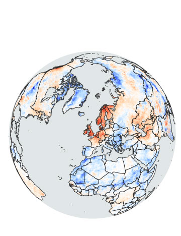
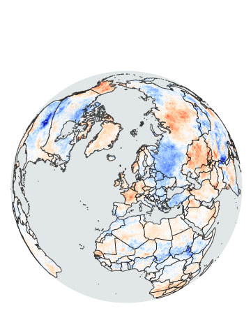
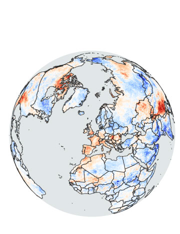
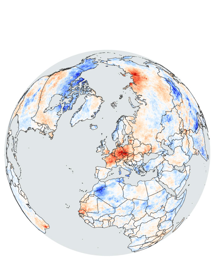
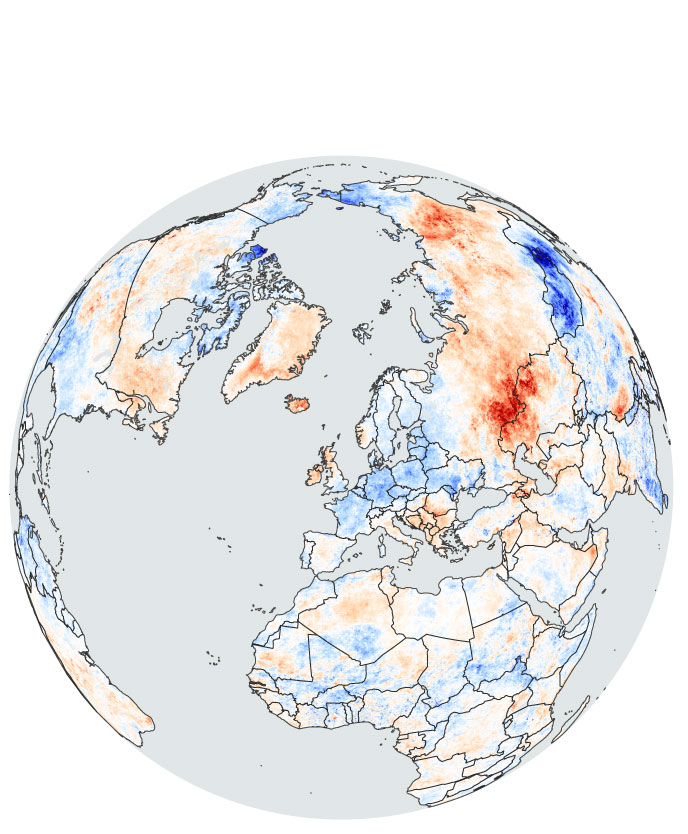
Or you can create something different. Sometimes, I like to make miniature globe maps using the Build Globe plugin in QGIS.
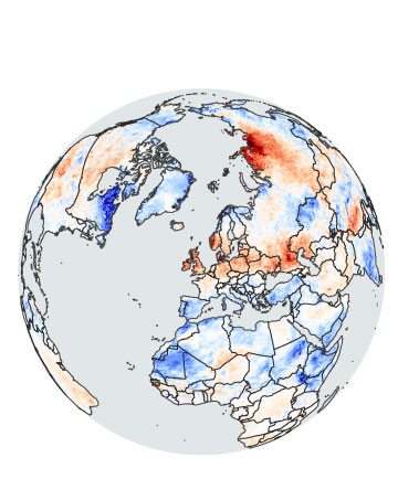
June 2018
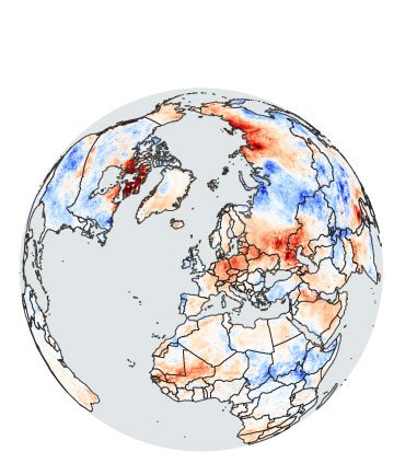
June 2019
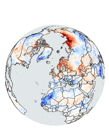
June 2020
June 2021
June 2022
July 2018
July 2019
July 2020
July 2021
July 2022
August 2018
August 2019
August 2020
August 2021
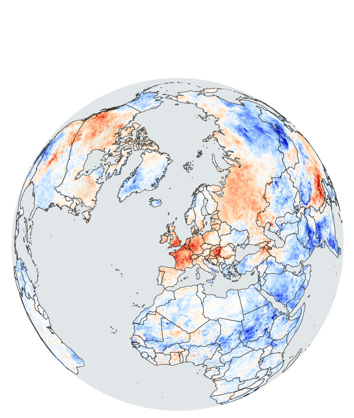
August 2022
Go back to Daniel González Cappa